Google Earth is an amazing program that brings the world to you. It’s also an amazing tool that also puts you in the driving seat of geography! Not entirely a Geographic Information System (which most normal people don’t need in any case), it does make it easy for you to interpret and “map” your own … Continue reading Google Earth, Maps, GPS tracks and geotagged photos
Tag: maps

IDP Dialogue Activities
The Early Recovery Project for the United Nations Development Programme needed to report on the progress of the Project to their donors. This map was part of the report to highlight the number of mediations and dialogues the Project had with local communities to help with reintegrating families who had left because of political crisis … Continue reading IDP Dialogue Activities
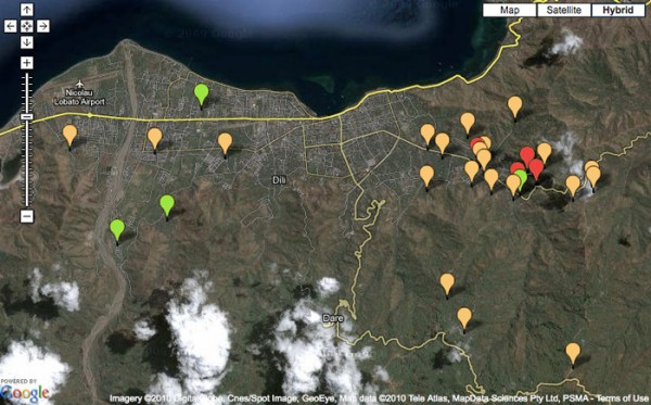
Google Map for Recovery Project Management
As part of a Early Recovery Project for the United Nations Development Programme in Timor-Leste, this interactive map was developed to showcase the possibility of using Google Maps and data from the project to help real-time project management and monitoring. The Google Map uses information entered into a Google spreadsheet to show the projects spatially … Continue reading Google Map for Recovery Project Management
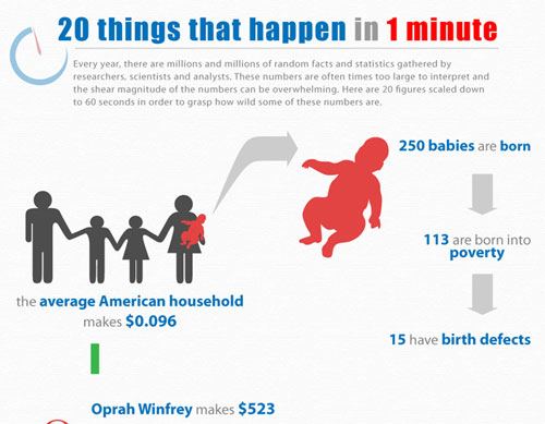
Data Can Be Cool.
Anytime you hear the word “data” or “statistics”, the image of a geeky-looking guy (probably with a pocket protector) probably comes to mind. We’ve come a long way from this image and hopefully the idea that data is boring and only for nerdy people will change. Technology has come a long way to both help … Continue reading Data Can Be Cool.
Day 4 (#GISDay) – It's all about the data!
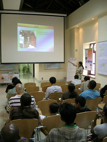
More and more people keep attending the afternoon seminars… including today’s presentation by the National Statistics Directorate of Timor-Leste. One of the key things in this 10-year old country is to get a better understanding about its population and what are the challenges to its growth. Timor-Leste will be conducting its national census next year … Continue reading Day 4 (#GISDay) – It's all about the data!
Day 3 (#GISDay) – Timor-Leste event is half-way through
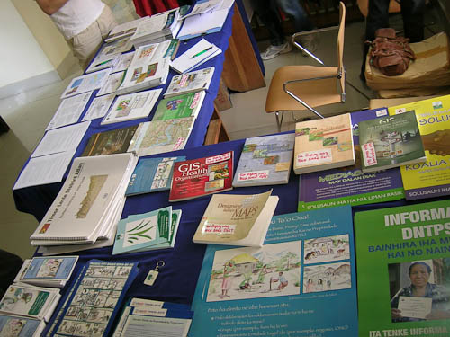
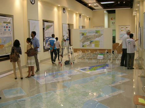
There’s 3 days left to With maps, we build the future of Timor-Leste at Casa Europa. I’ll try to get more pictures up of the different things that are going on for the week-long event. After three days, there’s been plenty of positive response from the event – a lot of people didn’t realize that … Continue reading Day 3 (#GISDay) – Timor-Leste event is half-way through
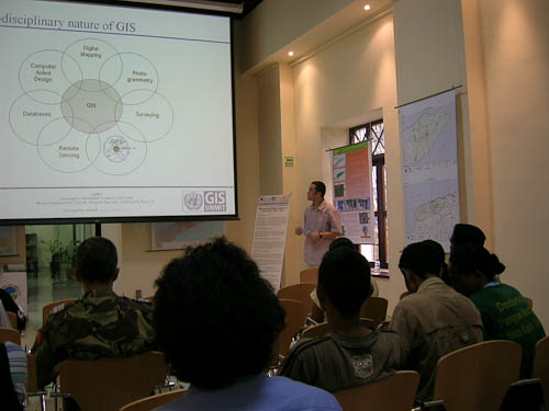
Day 2 (#GISDay) – Kids, military, uni students come for a visit
With maps, we build the future of Timor-Leste keeps going strong at Casa Europa. Day 2 was as popular as the first day. This time around there was a class field trip from the Dili International School who came for a visit – as you can see they were very interested in the 1:50000 floor … Continue reading Day 2 (#GISDay) – Kids, military, uni students come for a visit
Day 1 (#GISDay) – Success in Timor-Leste!
Coinciding with GIS Day, the first day of the GIS/mapping event in Timor-Leste (With maps, we build the future of Timor-Leste) was a success. Given this type of event is the first of its kind in the country, the opening day went smoothly… although there were some bumps along the way as I expected. But … Continue reading Day 1 (#GISDay) – Success in Timor-Leste!
Ho Mapa, Ita Harii Futuru Timor-Leste (#GISDay)
I’m part of the Timor-Leste Geographic Information Group (GIG). For the past few months we’ve been planning to organize an event to raise awareness about mapping and geographic information systems (GIS) work that is going on in Timor-Leste. There isn’t much information about GIS and mapping in Timor. So this event hopes to educate the … Continue reading Ho Mapa, Ita Harii Futuru Timor-Leste (#GISDay)